
Plans
Master plan
The master plan is founded upon the “Development Concept for the Restructuring of Bremen’s Former Docklands”, approved by the Senate and Parliament of Bremen in 2000. Drawn up in 2003, it formulates the urban development concept to transform the docklands to the right of the river Weser. It is an instrument of informal planning and forms the basis for all developments that have since been implemented in the Überseestadt. From the city centre outwards, the area is 3.5km long and at least 1km wide, stretching out along the Weser. The 300 hectares of land are delimited by the riverbanks, quays and walls, and these have a long-lasting impact on the city’s spaces and architecture.
The various plans are regularly adjusted and updated. However, the constantly new developments in the Überseestadt mean not all plans are always up-to-date.
Urban development plan
Urban development foundations
The urban development plan has transformed the modern-day image of the Überseestadt into a mixture of typical port architecture and urban design. Spaces are created by avenues, and green spaces and streets link the inland with the water. Numerous projects are still being planned or implemented at the moment. These developments are constantly changing the quarter.
Urban development plan (current PDF file on the right in the download area)

Utilisation plan
Structure and distribution of use
The former docklands to the right of the river Weser have become a vibrant quarter with various uses. It’s a place where the port and manufacturing industries meet modern service providers, retailers, housing, restaurants, cultural attractions and leisure activities. The aim is to create harmony through the various uses.
Utilisation plan (current PDF file on the right in the download area)

Plan for green and open spaces
Distribution of green and open spaces
An integral part of the urban structure is the design of its public spaces. The plan shows that several green spaces have been planned or already created in the Überseestadt. Green spaces for relaxation and exercise promote a high quality of life and offer something special to visitors, which is why they play such an important role in the design of this new quarter.
Plan for green and open spaces (current PDF file on the right in the download area)

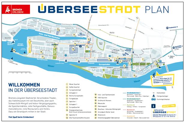
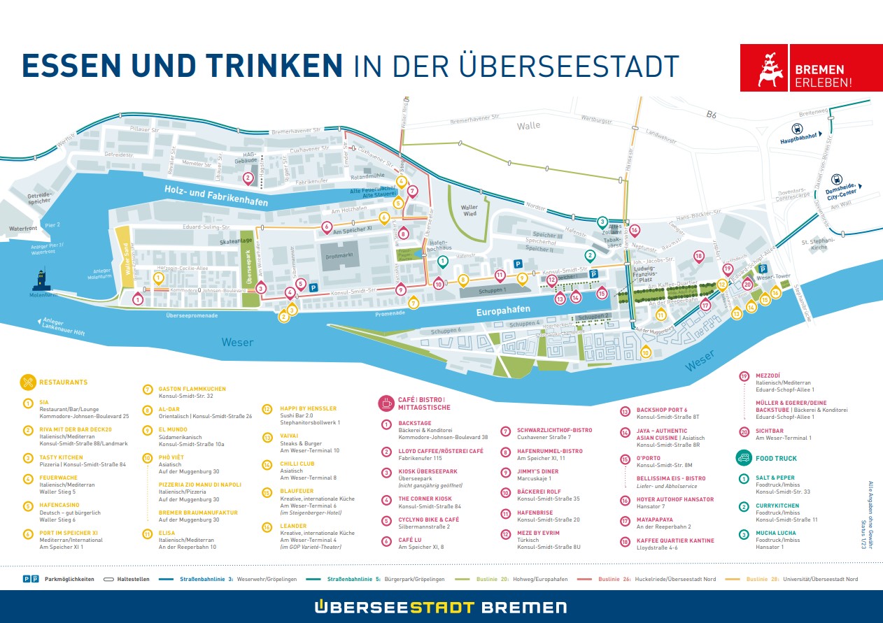
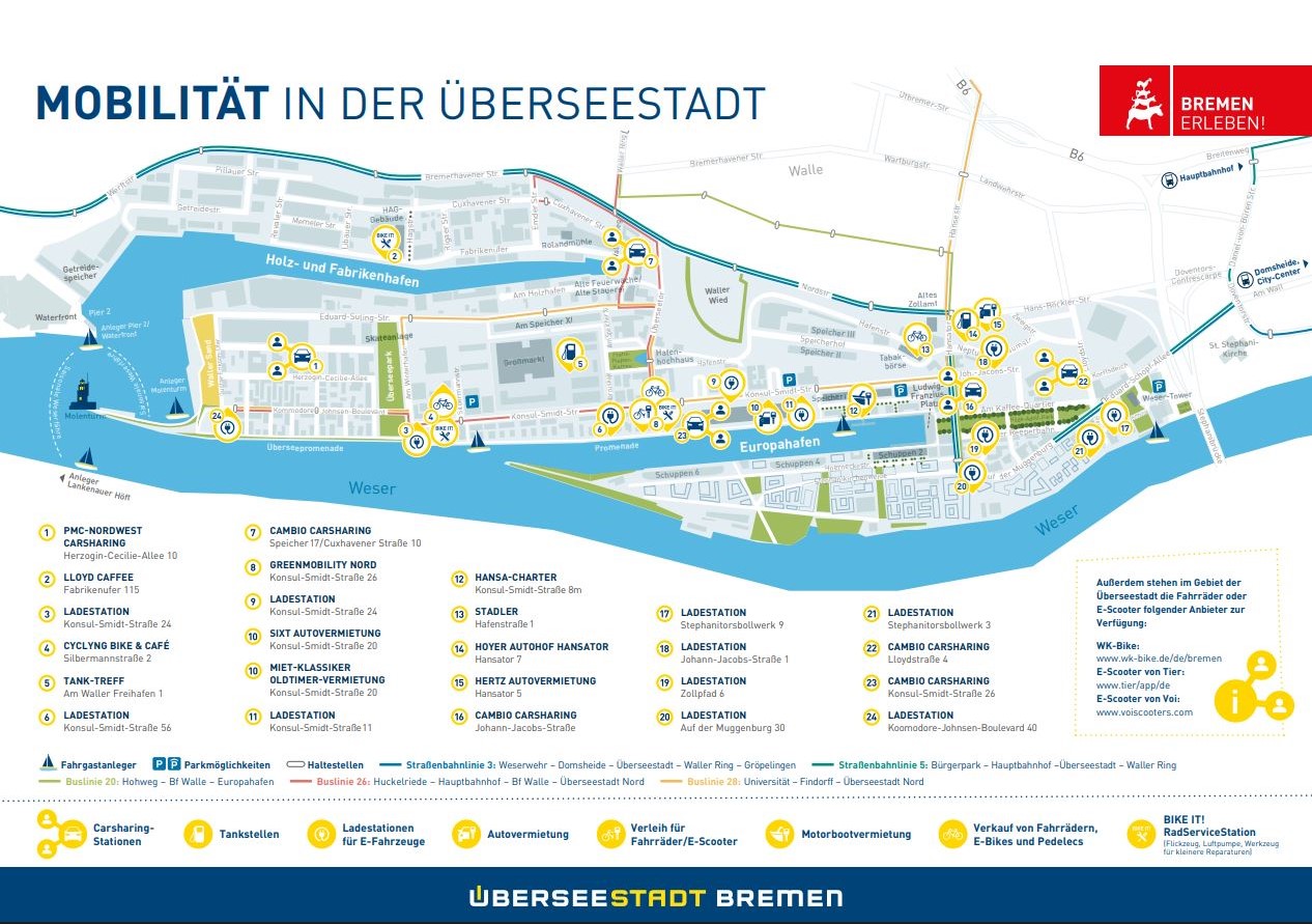
Tourist plan
With an area of almost 300 hectares, Bremen's Überseestadt is one of the largest urban development projects in Europe. The old port area is being transformed into a modern "location of opportunities" with a mix of services, offices, port business, logistics, leisure, residential and cultural facilities. WFB Wirtschaftsförderung Bremen GmbH is responsible for the development, opening up and marketing of Überseestadt on behalf of the Free Hanseatic City of Bremen.
These plans for visitors to Überseestadt provide information on shopping opportunities, cultural facilities, catering and mobility services and much more.
Tourist Überseestadt plan (current PDF file on the right in the download area)
Plan leaflet
The plan leaflet provides information on new developments and specific projects in the Überseestadt and offers an insight into the various possibilities brought about by successful commitment.
Plan leaflet 2018/2019 (Current PDF file on the right in the download area)

